Destinations

Destination Split

Split

Split is the second-largest city of Croatia and the largest city of the region of Dalmatia. It lies on the eastern shore of the Adriatic Sea and is spread over a central peninsula and its surroundings. An intraregional transport hub and popular tourist destination, the city is linked to the Adriatic islands and the Apennine peninsula.

Home to Diocletian's Palace, built for the Roman emperor in 305 CE, the city was founded as the Greek colony of Aspálathos (Aσπάλαθος) in the 3rd or 2nd century BC. It became a prominent settlement around 650 CE when it succeeded the ancient capital of the Roman province of Dalmatia, Salona. After the Sack of Salona by the Avars and Slavs, the fortified Palace of Diocletian was settled by the Roman refugees. Split became a Byzantine city, to later gradually drift into the sphere of the Republic of Venice and the Kingdom of Croatia, with the Byzantines retaining nominal suzerainty. For much of the High and Late Middle Ages, Split enjoyed autonomy as a free city, caught in the middle of a struggle between Venice and the King of Hungary for control over the Dalmatian cities.

Venice eventually prevailed and during the early modern period Split remained a Venetian city, a heavily fortified outpost surrounded by Ottoman territory. Its hinterland was won from the Ottomans in the Morean War of 1699, and in 1797, as Venice fell to Napoleon, the Treaty of Campo Formio rendered the city to the Habsburg Monarchy. In 1805, the Peace of Pressburg added it to the Napoleonic Kingdom of Italy and in 1806 it was included in the French Empire, becoming part of the Illyrian Provinces in 1809. After being occupied in 1813, it was eventually granted to the Austrian Empire following the Congress of Vienna, where the city remained a part of the Austrian Kingdom of Dalmatia until the fall of Austria-Hungary in 1918 and the formation of Yugoslavia.

Although the beginnings of Split are traditionally associated with the construction of Diocletian's Palace in 305 CE, the city was founded several centuries earlier as the Greek colony of Aspálathos, or Spálathos. It was a colony of the polis of Issa, the modern-day town of Vis, itself a colony of the Sicilian city of Syracuse. The exact year the city was founded is not known, but it's estimated to have been in the 3rd or 2nd century BCE. The Greek settlement lived off trade with the surrounding Illyrian tribes, mostly the Delmatae.

After the Illyrian Wars of 229 and 219 BCE, the city of Salona, only a short distance from Spálathos, became the capital of the Roman Province of Dalmatia. The history of Spálathos becomes obscure for a while at this point, being overshadowed by that of nearby Salona, to which it would later become successor. The Roman Emperor Diocletian (ruled 284 to 305 CE) in 293 CE began the construction of an opulent and heavily fortified palace fronting the sea, near his home town of Salona, selecting the site of Spálathos (or Spalatum in Latin). The Palace was built as a massive structure, much like a Roman military fortress. The palace and the city of Spalatum which formed its surroundings were at times inhabited by a population as large as 8,000 to 10,000 people.

Between 475 and 480 the Palace hosted Flavius Julius Nepos, the last recognised Emperor of the Western Roman Empire - despite Odoacer having abolished the Western Imperial throne with the deposition of Romulus Augustulus in 476. In 493 CE Salona, along with most of Dalmatia, was lost to the Ostrogothic Kingdom. However, in 535-536 CE the Emperor Justinian the Great regained Dalmatia to the by-then Byzantine Empire.

The Pannonian Avars sacked and destroyed Salona in 639 CE; the surviving Romans fled to the nearby islands. The Dalmatian region and its shores were at this time settled by tribes of Croats, a South Slavic people subservient to the Avar khagans. The Salonitans regained the land under Severus the Great in 650 CE and settled the 300-year-old Palace of Diocletian, which could not be effectively besieged by the Slavic tribes of the mainland. The Emperor Constans II granted them an Imperial mandate to establish themselves in the Palace as the City of Spalatum, which imposed upon the Croatian Slavs - at the time alied of Byzantium against the Avars - a cessation of hostilities. The Temple of Jupiter was rededicated it to the Virgin Mary and the remains of the popular Saint Domnius were recovered from the ruins of Salona, later establishing the Cathedral of Saint Domnius as new seat of the Archbishop of Salona. In 1100, the bell tower which became the main symbol of the city was constructed and dedicated to Saint Domnius, by then regarded as the patron saint of the city.

Omiš

Omiš

It is supposed that the name of this city, Omiš, developed from the Slavic Holm, Hum as a translation from the Illyrian - Greek word Onaion, Oneon, meaning "hill" or "place on the hill", or from Greek onos (όνος) meaning donkey, perhaps from the shape of the rocky promontory by the city (naming a city after a natural form was common practice then, as it is now); there is also the possibility that the name of the settlement Onaeum was derived from the name of the river which was called Nestos by the Greek colonists in its lower flow, during Antiquity. According to Petar Šimunović, Omiš is derived from Proto-Indo-European *almissa ("rock", "cliff").

Omiš was well known in the past by the Corsairs of Almissa (Omiški gusari) whose Sagittas (ships) (Genitive case: Sagittae, translated as The Arrow), brought fame to them because they were built for attack and fast retrieval into the mouth of the Cetina River, protecting the town from foreign invaders. At a very early date, neighbours of the Corsairs of Almissa, the highlanders of the Poljica Principality (Poljička Republika), became their friends and allies. This allowed them to harass the seaborne trade, without fear of a sudden attack from inland.

Historical monuments:

  • Church of St Euphemia by the coast on Brzet, from the early 6th century
  • Mirabella Fortress (Peovica) from the 13th century
  • Starigrad Fortress (Fortica) from the 15th century
  • Renaissance church of the Holy Spirit from the 15th century
  • Old cemetery, the 16th century or 17th century
  • Parochial church from the 17th century
  • Franciscan Monastery on Skalice from the 18th century

In the Priko neighborhood, on the right bank of the Cetina River, stands the site with the most historic significance: the pre-Romanesque Church of St. Peter (Crkva Sv. Petra) from the tenth century A.D. This single-naved edifice, with a cupola and apse, was used in the 18th century as a Glagolithic seminary for novice priests.

Krka National Park

Krka National Park

Krka National Park (Croatian: Nacionalni park Krka) is one of the Croatian national parks, named after the river Krka (ancient Greek: Kyrikos) that it encloses. It is located along the middle-lower course of the Krka River in central Dalmatia, in Šibenik-Knin county, downstream Miljevci area, and just a few kilometers northeast of the city of Šibenik. It was formed to protect the Krka River and is intended primarily for scientific, cultural, educational, recreational, and tourism activities. It is the seventh national park in Croatia and was proclaimed a national park in 1985.

The Krka National Park is located entirely within the territory of Šibenik-Knin County and encompasses an area of 109 square kilometers along the Krka River: two kilometers downriver from Knin to Skradin and the lower part of the river Čikola. The Krka National Park is a spacious, largely unchanged region of exceptional and multifaceted natural value, and includes one or more preserved or insignificantly altered ecosystems. The Krka Waterfalls has the second highest concentration of lavender per km squared in Europe, hence the high frequency of wasps and bees in the area.

Flora

The Krka National Park belongs to the Southern European (Mediterranean and sub-Mediterranean) region. Due to its special position and the mosaic distribution of various types of habitats, it is characterized by exceptionally rich and varied flora and fauna. Eight hundred and sixty species and subspecies of plants have been identified within the territory of the Krka National Park, including several endemic Illyrian-Adriatic species.

Fauna

Eighteen species of fish inhabit the Krka River, among which ten are endemic, making the Krka a natural landmark of the highest category. Brown trout and Dalmatian barbelgudgeon are a couple of fish that can be found in the ecosystem. Patches of reeds, lakes formed along part of the river and swamped meadows abound in amphibians and birds, while thickets and stone quarries are home to reptiles.

The abundance of species of birds (222), the structure of the bird communities and the great significance of the Krka for spring and autumn migrations make it among the ornithologically most valuable regions of Europe. There are numerous birds of prey in the area, notable ones are: osprey, short-toed eagle, golden eagle, Bonelli's eagle, lanner falcon and the peregrine falcon. Other birds of interest are Eurasian eagle-owl, European bee-eater and griffon vulture. Among mammals, there are 18 species of bats, which are generally endangered or near extinction in the rest of Europe, long-fingered bat, the Daubenton's bat, and the threatened European otter.

Plitvice Lakes National Park

Plitvice Lakes National Park

Plitvice Lakes National Park (Croatian: Nacionalni park Plitvička jezera, colloquial Plitvice, pronounced [plîtʋitse]) is one of the oldest and the largest national park in Croatia. In 1979, Plitvice Lakes National Park was added to the UNESCO World Heritage register.

The national park was founded in 1949 and is situated in the mountainous karst area of central Croatia, at the border to Bosnia and Herzegovina. The important north-south road connection, which passes through the national park area, connects the Croatian inland with the Adriatic coastal region.

The protected area extends over 296.85 square kilometres (73,350 acres). About 90% of this area is part of Lika-Senj County, while the remaining 10% is part of Karlovac County.

Each year, more than 1 million visitors are recorded. Entrance is subject to variable charges, up to 180 kuna or around €24 per adult in peak season.

The national park is world-famous for its lakes arranged in cascades. Currently, 16 lakes can be seen from the surface. These lakes are a result of the confluence of several small rivers and subterranean karst rivers. The lakes are all interconnected and follow the water flow. They are separated by natural dams of travertine, which is deposited by the action of moss, algae, and bacteria. The particularly sensitive travertine barriers are the result of an interplay between water, air and plants. The encrusted plants and bacteria accumulate on top of each other, forming travertine barriers which grow at the rate of about 1 cm (0.4 in) per year.

he sixteen lakes are separated into an upper and lower cluster formed by runoff from the mountains, descending from an altitude of 636 to 503 m (2,087 to 1,650 ft) over a distance of some eight km, aligned in a south-north direction. The lakes collectively cover an area of about two square kilometres (0.77 square miles), with the water exiting from the lowest lake forming the Korana River.

The lakes are renowned for their distinctive colors, ranging from azure to green, grey or blue. The colors change constantly depending on the quantity of minerals or organisms in the water and the angle of sunlight. Through different climatic influences and the large difference in elevation within the protected area, a multifaceted flora and fauna has been created. The national park area is home to many endemic species. Those species that prevailed at the lakes before the arrival of man still exist.

Dubrovnik

Dubrovnik

The names Dubrovnik and Ragusa co-existed for several centuries. Ragusa, recorded in various forms since at least the 10th century, remained the official name of the Republic of Ragusa until 1808, and of the city within the Kingdom of Dalmatia until 1918, while Dubrovnik, first recorded in the late 12th century, was in widespread use by the late 16th or early 17th century.

The name Dubrovnik of the Adriatic city is first recorded in the Charter of Ban Kulin (1189). It is mostly explained as "dubron", a Celtic name for water (Gaulish dubron, Irish dobar, Welsh dubr/dwfr, Cornish dofer), akin to the toponyms Douvres, Dover, and Tauber.

After the fall of the Ostrogothic Kingdom, the town came under the protection of the Byzantine Empire. Dubrovnik in those medieval centuries had a Roman population. After the Crusades, Dubrovnik came under the sovereignty of Venice (1205–1358), which would give its institutions to the Dalmatian city. After a fire destroyed almost the whole city in the night of August 16, 1296, a new urban plan was developed. By the Peace Treaty of Zadar in 1358, Dubrovnik achieved relative independence as a vassal-state of the Kingdom of Hungary.

Between the 14th century and 1808, Dubrovnik ruled itself as a free state, although it was a vassal from 1382 to 1804 of the Ottoman Empire and paid an annual tribute to its sultan. The Republic reached its peak in the 15th and 16th centuries, when its thalassocracy rivalled that of the Republic of Venice and other Italian maritime republics.

For centuries, Dubrovnik was an ally of Ancona, the other Adriatic maritime republic rival of Venice, which was the Ottoman Empire's chief rival for control of the Adriatic. This alliance enabled the two towns set on opposite sides of the Adriatic to resist attempts by the Venetians to make the Adriatic a "Venetian Bay", also controlling directly or indirectly all the Adriatic ports. Ancona and Dubrovnik developed an alternative trade route to the Venetian (Venice-Austria-Germany): starting in Dubrovnik it went on to Ancona, through Florence and ended in Flanders.

Climate

Dubrovnik has a borderline humid subtropical (Cfa) and Mediterranean climate (Csa) in the Köppen climate classification, since only one summer month has less than 40 mm (1.6 in) of rainfall, preventing it from being classified as solely humid subtropical or Mediterranean. It has hot, muggy, moderately dry summers and mild to cool, wet winters. The Bora wind blows cold gusts down the Adriatic coast between October and April, and thundery conditions are common all the year round, even in summer, when they interrupt the warm, sunny days. The air temperatures can slightly vary, depending on the area or region. Typically, in July and August daytime maximum temperatures reach 28 °C (82 °F), and at night drop to around 23 °C (73 °F). In Spring and Autumn maximum temperatures are typically between 20 °C (68 °F) and 28 °C (82 °F). Winters are among the mildest of any Croatian city, with daytime temperatures around 13 °C (55 °F) in the coldest months. Snow in Dubrovnik is very rare.

Mostar

Mostar

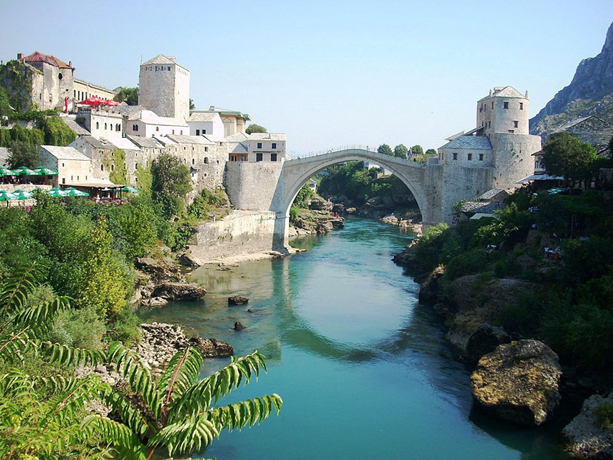
It is the most important city in the Herzegovina region, its cultural capital, and the center of the Herzegovina-Neretva Canton of the Federation. Mostar is situated on the Neretva River and is the fifth-largest city in the country. Mostar was named after the bridge keepers (mostari) who in the medieval times guarded the Stari Most (Old Bridge) over the Neretva. The Old Bridge, built by the Ottomans in the 16th century, is one of Bosnia and Herzegovina's most recognizable landmarks, and is considered one of the most exemplary pieces of Islamic architecture in the Balkans.

As far as medieval Mostar goes, although the Christian basilicas of late antiquity remained in use, few historical sources were preserved and not much is known about this period. The name of Mostar was first mentioned in a document dating from 1474, taking its name from the bridge-keepers (mostari); this refers to the existence of a wooden bridge from the market on the left bank of the river which was used by traders, soldiers, and other travelers. During this time it was also the seat of a kadiluk (district with a regional judge). Since Mostar was on the trade route between the Adriatic and the mineral-rich regions of central Bosnia, the settlement began to spread to the right bank of the river.

Mostar has architecturally noteworthy buildings in a wide range of styles. Historicist architectural styles reflected cosmopolitan interest and exposure to foreign aesthetic trends and were artfully merged with indigenous styles. Examples include the Italianate Franciscan church, the Ottoman Muslibegovića house, the Dalmatian Corovic House and an Orthodox church which was built as gift from the Sultan.

The Ottomans used monumental architecture to affirm, extend and consolidate their colonial holdings. Administrators and bureaucrats – many of them indigenous people who converted from Christianity to Islam – founded mosque complexes that generally included Koranic schools, soup kitchens or markets.

Out of the thirteen original mosques dating from the 16th and 17th centuries, seven have been lost during the 20th century for ideological reasons or by bombardment. One of the two 19th-century Orthodox churches has also disappeared, while the early 20th-century synagogue, after suffering severe damage in the World War II, has been converted into a theatre. Several Ottoman inns also survived, along with other buildings from this period of Mostar's history, such as fountains and schools.

Brela

Brela

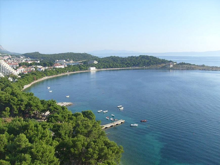
Brela is a municipality in the Split-Dalmatia County of Croatia, population 1,771 (2001). The municipality consists of two villages: Brela and Gornja Brela. Village Brela is located on the Adriatic coastline of Dalmatia, about 15 km northwest of Makarska.

Brela is a tourist town located between the Biokovo mountain and the Adriatic Sea. It is known as the pearl of Makarska riviera. The pearl of Adriatic or the pearl of Mediterranean is the name given to the city of Dubrovnik. In 1968 Brela was crowned as "Champion of Adriatic" for high achievements in tourist activity.

The symbol of Brela is "Kamen Brela" (Brela Stone), a small rock island just off the main beach in Brela, the Punta Rata beach. In 2004, American magazine Forbes put the Punta Rata beach on the list of 10 world's most beautiful beaches, where it is ranked 6th in the world and 1st in Europe.

Baška Voda

Baška Voda

Baška Voda is a municipality in Croatia in the Split-Dalmatia County. It has a population of 2,775 (2011 census), 96.2% of which are Croats. It is located on the Adriatic coastline of Dalmatia 10 km northwest of Makarska.

In ancient times, the little village of Bast nestled by a freshwater spring which supplied the Biokovo area. During the 18th century, after the expulsion of the Turks, its inhabitant left the slopes of St. Ilija's (Elijah's) Ridge and descended to the shore, where they established Baška Voda, today a well-known tourist resort on the Makarska Riviera.

The name Baška Voda is mythological in origin and is linked with Biston, the patriarch of the Thracian Biston tribe, son of Ares, the Greek god of war, and the goddess Calliope, protectress of water. The military fort and springs near Baška Voda bear out this theory. Some of the richest archaeological sites that have yielded finds from Roman times are on the heights of Gradina and its surroundings.

These include burial sites with urns, lamps, jewellery, coins with the head of Alexander Severus Aurelianus and headstones bearing the names of 13 of the ancient inhabitants of Baška Voda, the loveliest of which commemorates a boy called Ursinus, who died in a shipwreck between 100 and 150 AD.

Baška Voda first appeared on the “Coranelli” geographical map, produced in 1688, as “Basca”. It was a small village which thrived on agriculture and fishing. The Late Baroque church of St. Lovro (Laurence), built in 1750, probably occupies an Antique site, while the parish church of St. Nikola (Nicholas), the patron saint of travellers and sailors, was built in the early 20th century.

Makarska

Makarska

Makarska is a small city on the Adriatic coastline of Croatia, about 60 km (37 mi) southeast of Split and 140 km (87 mi) northwest of Dubrovnik. It has a population of 13,834 residents. Administratively Makarska has the status of a city and it is part of the Split-Dalmatia County.

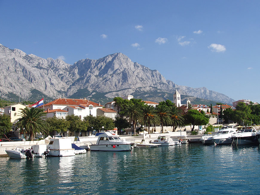
Makarska is a tourist centre, located on a horseshoe shaped bay between the Biokovo mountains and the Adriatic Sea. The city is noted for its palm-fringed promenade, where cafes, bars and boutiques overlook the harbour. Adjacent to the beach are several large capacity hotels as well as a camping ground.

The center of Makarska is an old town with narrow stone-paved streets, a main church square where there is a flower and fruit market, and a Franciscan monastery that houses a sea shell collection featuring a giant clam shell. Makarska is the center of the Makarska Riviera, a popular tourist destination under the Biokovo mountain. It stretches for 60 km (37 mi) between the towns of Brela and Gradac. Its former cathedral of Saint Mark was the see of the former Roman Catholic Diocese of Makarska which was merged in 1828 into the Diocese of Split-Makarska.

Near present-day Makarska, there was a settlement as early as the middle of the 2nd millennium BC. It is thought that it was a point used by the Cretans on their way up to the Adriatic (the so-called "amber road"). However it was only one of the ports with links with the wider Mediterranean, as shown by a copper tablet with Cretan and Egyptian systems of measurement.

Although the Romans became rulers of the Adriatic by defeating the Ardiaei in 228, it took them two centuries to confirm their rule. The Romans sent their veteran soldiers to settle in Makarska. After the division of the Empire in 395, this part of the Adriatic became part of the Eastern Roman Empire and many people fled to Muccurum from the new wave of invaders. The city appears in the Tabula Peutingeriana as the port of Inaronia, but is mentioned as Muccurum, a larger settlement that grew up in the most inaccessible part of Biokovo mountain, probably at the very edge of the Roman civilisation. It appears on the acts of the Salonan Synod of 4 May 533 AD held in Salona (533), when also the town's diocese was created.

During the Migration Period, in 548, Muccurum was destroyed by the army of the Ostrogoth king Totila. The byzantine Emperor expelled the Eastern Goths (Ostrogoths). In the 7th century the region between the Cetina and Neretva was occupied by the Narentines, with Mokro, located in today's Makarska, as its administrative centre. The doge of Venice Pietro I Candiano, whose Venetian fleet aimed to punish the piratesque activities of the city's vessels, was defeated here on September 18, 877 and had to pay tribute to the Narentines for the free passage of its ships on the Adriatic.